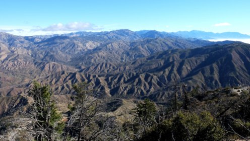
These past few months I explored local day hikes to Mount Lowe, Josephine Peak and Strawberry Peak, located in the San Gabriel Mountains, off the Angeles Crest Highway. All three hikes are in close proximity to each other and each trail is less than 10 miles in distance. I was pleasantly surprised that these underrated hikes are close to Los Angeles, offer spectacular views, and are relatively low trafficked. Here is a quick review of each in order of difficulty.
Mount Lowe
Distance: 6.1 miles | Elevation Gain: 1206 ft | Difficulty: Easy
I recommend this hike to any beginners or out of town visitors. It’s an easy introductory hike that offers some stunning views of the San Gabriel Mountains and greater Los Angeles area. It’s also a quick hike, in close proximity to other trails so you can easily tack on neighboring San Gabriel Peak or Mount Markham to your excursion. To get there, drive along Angeles Crest Highway for almost 14 miles until you come across Red Box picnic area. Turn right onto Mount Wilson Red Box Road until you come to a small dirt parking lot. Display your adventure pass.
The first time I hiked Mount Lowe, I opted to hike the trail in the evening in October to watch the super moon rise. Although a little rocky, it’s a fairly easy, straight-forward path. Along the trail you will cross through Mueller Tunnel, built in 1942 by the US Forest service as a gateway to Mount Lowe.
At the turn of the 20th century the summit of Mount Lowe was the location of the Alpine Tavern and Pacific Electric Railway. The tavern burned down in 1936 in an electrical fire, and shortly after the railway went into disuse after a series of brush fires and floods. The foundation of the Alpine Tavern is still visible along with viewing tubes, similar to the ones found at Inspiration Point. The views from the top are quite striking. To the West you can spot Mount Wilson along with Mount Baldy and to the South you can see the greater Los Angeles area. Although I hiked Mount Lowe on a hazy evening, I could even see as far as the ocean and even Catalina Island!
Josephine Peak
Distance: 8 miles | Elevation Gain: 1898 ft | Difficulty: Moderate
To get to the trailhead from La Canada Flintridge, drive along Angeles Crest Highway for almost 12 miles until you reach the Clear Creek Ranger station. Park across the street from the station and display your Adventure Pass. The trail begins at the fire road on the east side of the Angeles Forest Highway.
The trail itself is an easy to follow, fire road with a steady incline. I would suggest hiking it early in the morning or during the cooler SoCal winter months as most of the trail is exposed. The trail itself is not spectacular, but the view from the top is completely worth it! It’s a staight-forward fire road that has suffered the effects of the 2009 station fire, and has suffered further from the drought of the past few years. With that said the trail is very low trafficked. I’ve hiked it a few times now one the weekends and rarely see another soul on the trail. The large fire road also makes this hike good for families and group hikes.
At about 2.5 miles the trail forks, stay left and continue following the fire road. The trail on the right is an alternate route to Strawberry Peak. The most rewarding part of the hike is reaching the summit and taking in the gorgeous 360 degree view!
Strawberry Peak
Distance: 7.5 miles | Elevation Gain: 1510 ft | Difficulty: Challenging
Strawberry Peak is the highest summit in the front range of the San Gabriel Mountains at 6,164 ft, beating nearby San Gabriel Peak by a mere yard! Legend has it the peak got it’s name from resembling an upside down strawberry. There are a few trails that lead to Strawberry Peak (the west side of the mountain is the mountaineer route, that includes Class Three bouldering!) For safety’s sake I opted out of bouldering and started on the East side of the mountain, from Red Box Picnic Area. Park in the picnic area and display your Adventure Pass. The trail is just on the other side of the highway, across from Red Box picnic area.
The first 2.5 miles follow a fairly easy single track trail. Even though this is slightly less milage than Josephine Peak, the second half of the trail is a steep climb, making this hike much more challenging. The surrounding area has also suffered from the 2009 station fire, making it at times difficult to identify the trail.
At the top the views are quite stunning. You can see neighboring Josephine Peak to the east as well as Mount Wilson to the west. I hiked on an overcast day, but once I reached the summit I was well above the clouds. From the top it looked like an eternal sea of clouds nestled between the mountains!


These hikes look stunning Jess! I have to to venture onto the moutain trails in LA county, but I look forward to checking out these and more in 2017!!
LikeLike
The west approach to Strawberry Peak is by far my favorite hike, climb of the great lower peaks of the SGM’s…
2heeldrivin.wordpress.com
LikeLike